Who We Are
Valentino & Associates Land Surveyors in Atlanta is a full-service land surveying firm in Atlanta, Georgia with over 30 years of land surveying experience in the Atlanta area as well as North Georgia, Savannah, and Central Georgia. Valentino & Associates provides an extensive range of professional land surveying services from commercial, and industrial surveys, to institutional, school, municipal, and residential surveys. While there will always be a time and place for traditional surveying, Valentino & Associates Land Surveying embraces technological innovations to advance the industry and support clients in an increasingly data-driven world. Our experience and highly skilled employees make use of next generation drone and Lidar technology, GPS, Laser Scanning, and Hydrographic surveying technologies to position us as one of the leading land surveying firms in the state of Georgia.”
By investing in technology year after year, we’re able to provide accuracy, efficiency, and quality at a competitive price and keep our clients happy.
Meet our Team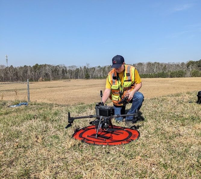
Our Expertise
Valentino & Associates Land Surveyors has proven expertise in the areas of – Boundary and Topographic Surveys, ALTA/NSPS Land Title Surveys, Construction Layout, Staking, and Design, Drone Surveys, 3-D Laser Scanning, and Interior and Exterior As-Builts. Here at Valentino & Associates we believe thatexperience alone will not insure a successful surveying project. We apply the latest in surveying technology and implement aggressive surveying project management techniques to guarantee a quality product.
Our ServicesV&A HAS PROVEN EXPERTISE IN THESE AREAS
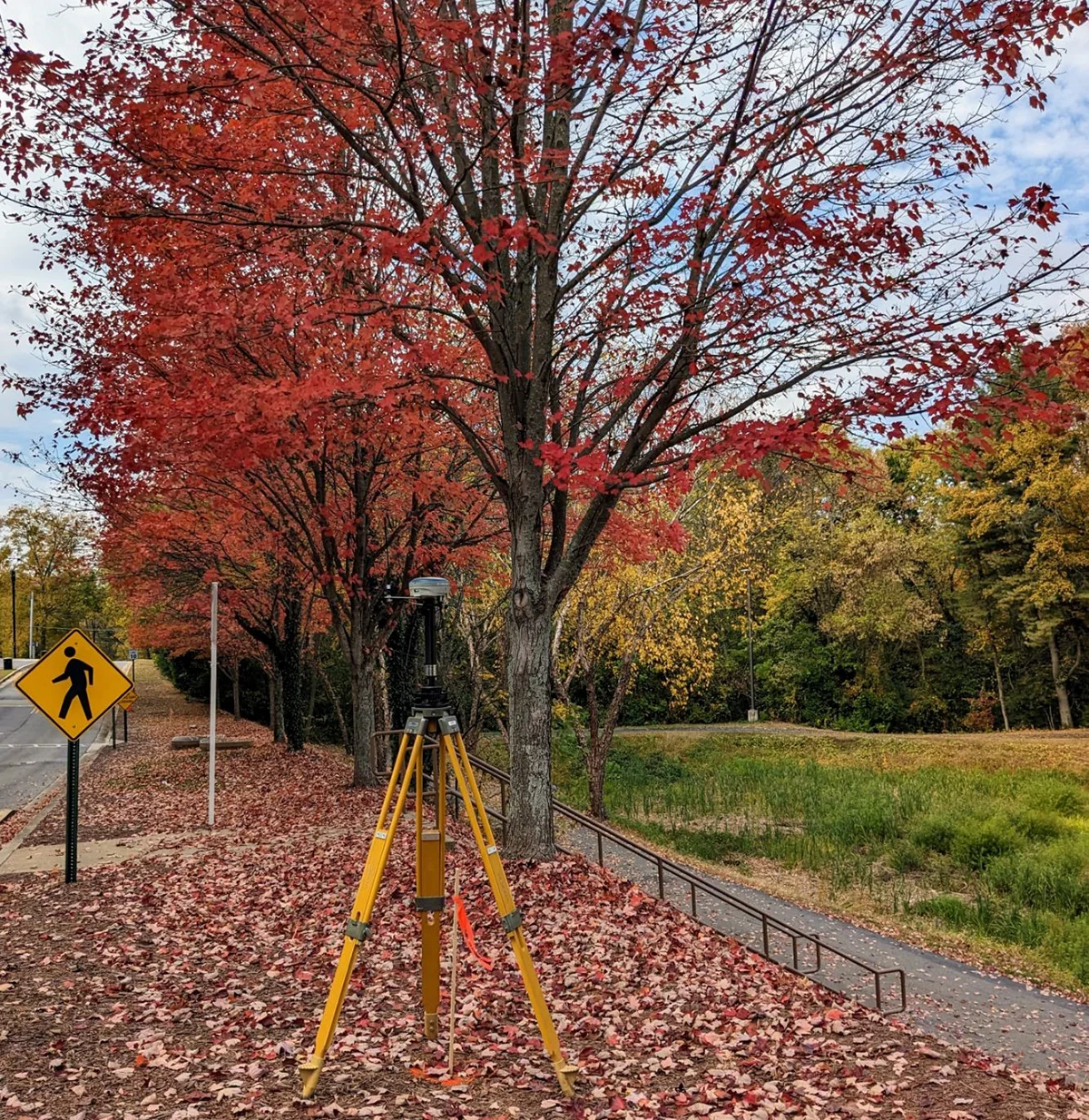
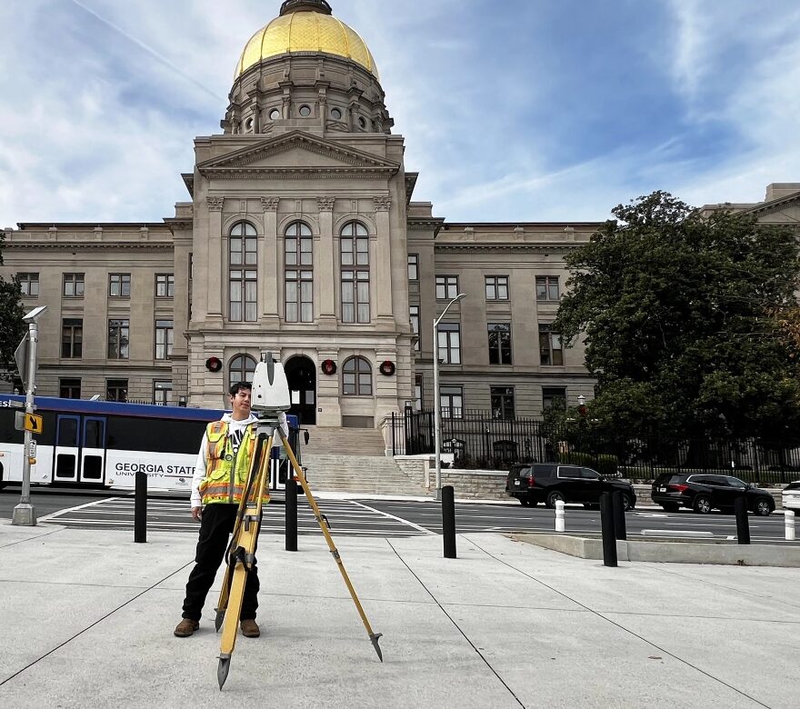
REAL PEOPLE, ADVANCED TECHNOLOGY

Our experience and highly skilled employees make use of next generation drone and Lidar technology, GPS, Laser Scanning, and Hydrographic surveying technologies to position us as one of the leading land surveying firms in the state of Georgia.”
Dillon Hamilton
Clients
At Valentino & Associates Land Surveying our main focus is our clients and it shows. In fact, 75% of our Atlanta and Georgia land surveying business is repeat business from client referrals and from existing long-term Engineering, Construction, Land Development, and Real Estate Management clients.
We provide services to Commercial, Industrial, Institutional, School, Municipal, and Residential Clients, and have extensive experience surveying large warehouse developments throughout Georgia, major on-line retailers and technology clients. We also have experience managing large municipal projects for schools, hospitals, and government sites.


Featured Projects
Valentino & Associates were requested to conduct a topographic survey on a moderately large employee parking lot and a portion of the trailer parking and distribution area for a warehouse in Coweta County.
Read Case Study ›An ALTA/NSPS Land Title Survey, LIDAR topographic survey, and a Bathymetric survey on the existing lakes/ ponds had to be conducted in little to no time. So, Valentino & Associates stepped up to the plate to take on the project.
Read Case Study ›Our loyal client contacted Valentino & Associates with a concern that they were running into a problem as the interior of their warehouse was being constructed.
Read Case Study ›We used our highly accurate robotic total stations as well as a digital level which reads elevations to the thousandth of a foot to collect all the necessary data to complete the survey as requested by the construction contractor.
Read Case Study ›